150 years of the Journal of Surveying Engineering
Publication: Journal of Surveying Engineering
Volume 150, Issue 4
The journal editors of the last 40 years—in respectful memory of David A. Wahlstrom (editor, 1989–1992), deceased—have joined in this editorial to commemorate the 150th anniversary of the Journal of Surveying Engineering, an exciting milestone for the oldest periodical in the field with wide international recognition and a century and a half of continuous publishing.
Sergio Baselga (Editor, 2023–Present)
As the current editor in chief of the journal, I want to start by thanking the former editors who have agreed to participate in this editorial, in which they are given the floor to reflect on the changes in the journal and the evolution of the surveying engineering profession. Their experience as outstanding leaders in both is a valuable source of knowledge and an inspiration for new generations. Also, to illustrate how things change with the times, a list of papers that reflect our past and help us imagine the future has been prepared and made available for free on the ASCE journals website (https://ascelibrary.org/celebrating150) until December 31, 2024, as part of the 150th anniversary commemoration initiatives. This list consists of one paper per decade, starting in the 1960s (due to website availability), as follows:
•
“Electronic Surveying: Electronic Distance Measurements,” in which the author rigorously addressed the use of electronic distance meters, including the necessary corrections (Harrison 1963).
•
“Automation in Surveying and Mapping: Present and Future,” in which the author addressed the up-to-date automation procedures used in surveying at the time and pointed out the technological developments whose widespread use was just around the corner (Thompson 1977).
•
“Centimeter-Level Relative Positioning with GPS,” in which the authors showed the results of baselines measured with the macrometer, the first global navigation satellite system (GNSS) instrument with built-in ambiguity-fixing ability yielding centimeter accuracy (Counselman et al. 1983).
•
“Future of Surveying Engineering—A Perspective from Greece,” which is surprisingly topical today and an example of how the journal also became a reference for international contributors in this decade (Kavouras 1995).
•
“Continuously Operating Reference Station (CORS): History, Applications, and Future Enhancements,” which reflects the development of this GNSS-based service that supports a wide variety of applications today (Snay and Soler 2008).
•
“Accuracy of Digital Surface Models and Orthophotos Derived from Unmanned Aerial Vehicle Photogrammetry” as an example of the advent of drone technologies in surveying engineering (Agüera-Vega et al. 2017).
•
Finally, “First Assessment Results of Surveying Engineering Labs in Immersive and Interactive Virtual Reality,” which shows results from the use of emerging technologies that may indicate future directions (Bolkas et al. 2022).
I have already given my views on the present and future of the journal and the profession in my inaugural editorial (Baselga 2023) and the “Meet the Editor” section of the journal’s web page. As a recap of the challenges that the surveying engineer should face armed with rigor and solid knowledge, I would like to emphasize the surveying engineer’s current need to deal with different coordinate frames, different observation epochs, different observation types of disparate origin and quality, and a long list of upsetting questions that, if handled improperly, can ruin their work. To worsen things a bit more, the proliferation of automated products and solutions for the acquisition of all types of geospatial information may provide a false sense of security to the degree that the expert in geomatics may be regarded as unnecessary in the deceptively simple process of obtaining coordinates—until it becomes clear that something has gone wrong. In other words, in surveying engineering, the effects of bad practices may only become apparent when it is already too late! The rigorous treatment of measurements and coordinates, and the sound estimation of their corresponding accuracies, must be the motto at work because it is what typically sets apart the professional surveying engineer from other professionals working with coordinates.
The former editors now recount their first-person experiences.
Alfred Leick (Editor, 1980–1985)
I recall that during my tenure as editor several megatrends in measurement technology, computer communication, and data management moved to the forefront, suggesting expanding the journal’s scope to help surveying professionals address these developments and ensure optimal use of accurate positioning data. The search for a new name, very predictably, aroused many compassionate and well-meaning responses. New names, such as geomatics or geomatic engineering, had been front-runners but eventually lost to the more familiar but all-inclusive term of surveying engineering. In 1983, Volume 109, Issue 1, the journal’s name changed from Journal of the Surveying and Mapping Division to Journal of Surveying Engineering.
Reports of the National Research Council (NRC), Need for a Multipurpose Cadastre (National Research Council 1980) and Procedures and Standards for a Multipurpose Cadastre (National Research Council 1983), indicated areas of development to which surveying engineering could significantly contribute because of its mastery of precise spatial positioning. The cadastre has a long history in many parts of the world as a repository of documents to secure property rights and accurate location data delineating respective rights on the earth’s surface. A big boost to the creation of the cadastral institution seemed to have happened in Europe when Napoleon Bonaparte ordered, presumably for taxation, its systematic establishment that included records documenting ownership and numerical measurements specifying the exact physical locations. The NRC reports emphasized the “multipurpose” concept, taking a broader view than the classical cadastre, thus opening the door even wider for surveying engineering to contribute with its many diverse but accurate location-linked data sets. While the institution of the classical cadastre did not take a foothold in the United States, several existing repositories, entities, and practices with spatial positioning components including the Massachusetts Land Court, Bureau of Land Management, Registries of Deeds, and countless geographic information systems (GISs) and land information systems operated at the local level of government or privately. All of these ingest spatial positioning data in various forms and accuracy levels.
GPS is an example of several measurement technologies emerging during that time that quickly established themselves as indispensable tools for spatial positioning. Two of the early projects clearly showed the revolutionary impact GPS would eventually have on surveying engineering. The first project used GPS to densify the classical Montgomery County geodetic network located in Pennsylvania. Although the observation time was still in the range of hours, centimeter-level baseline accuracy was achieved. The other project was the Stanford Linear Accelerator GPS survey, which achieved millimeter baseline accuracy.
The forthcoming revolution in communication capability also became evident during that period. Universities began to use BITNET (Because It’s There NETwork). This electronic network facilitated communication between researchers utilizing electronic text messages, email, and file transfers. In these pioneering days, the Kermit protocol, designed and maintained by Columbia University, was used for intercomputer data transfer. While voice and video transfer by digital data came later, I vividly recall my astonishment when a colleague electronically transferred a digital draft of his book, including figures and equations, from his former university. Although primarily (or exclusively) mainframe computers were involved, many discussion groups had already emerged. This experience made clear that surveying engineers would soon conveniently transfer their location-based data and reports to a repository and contribute to collecting spatial data.
The term database entered the vocabulary. I want to mention the commencing research on distributed databases, which tried to tackle the problem of accessing and managing space-related information stored in different places (computers) and services. There was also ongoing research on expert systems (i.e., land information systems) to help make decisions that required expert knowledge using a knowledge base. These could be viewed as a first step of artificial intelligence (AI).
The sample of technical developments and research activities briefly outlined here provided background justification for renaming the journal. It was to enable or promote surveying engineering as a primary contributor of accurate geopositioning data that met geodetic quality standards and a builder and manager of spatial databases that require such data. This expanded scope of anticipated activities, of course, included traditional engineering and property boundary surveying.
Earl Burkholder (Editor, 1985–1989 and 1992–1996)
I first agreed to serve as assistant editor for the ASCE Journal of the Surveying and Mapping Division to assist the new editor chosen to replace Alfred Leick. However, that term of service was short-lived because the new editor was not a member of ASCE. With assurances of support from the Division Executive Committee (EXCOM), I agreed to assume the editorial duties. I inherited a pool of excellent reviewers, ASCE staff provided guidance for operational details, and writers were sympathetic to my learning curve.
At that time, EXCOM pushed the idea of quarterly publication. Prior to 1988, the journal was usually published once or twice a year, although in some years there were more issues (for example, three in 1963 and 1987). Quarterly status was achieved in 1988. The goal of quarterly publication was bolstered by collecting, reviewing, and publishing papers from the ASCE specialty conference in Nashville, GPS ’88: Engineering Applications of GPS Satellite Surveying Technology.
In 1988, new GPS technology was being promoted aggressively by those seeking a competitive edge. The challenge (for the editor and reviewers) was finding the right balance between papers of academic merit and crass commercialization. I made mistakes and learned a lot, but ASCE circled the wagons on my behalf, and the threatened loss of advertising to ASCE never materialized. The academic/commercial balance still deserves attention.
The digital revolution has fostered many advancements in the past 50 years, illustrated in part by the selection of papers by current editor Baselga describing changes in practice decade by decade. Data collection and processing have been enhanced by miniaturization and strategic positioning of sensors. Signal processing has advanced via neural networks to include, among others, concepts of AI. Big data is supported by seemingly unlimited storage capacity. Business and professional practices have advanced rapidly by digitizing everything and automating computational processes. More recently, educational processes are adapting to just-in-time learning. Future challenges and advances are inevitable.
President Bill Clinton signed Executive Order 12906 on April 11, 1994, establishing the National Spatial Data Infrastructure (NSDI) with administration of the same delegated to the Federal Geographic Data Committee (FGDC). That watershed event was discussed in the August 1995 editorial of the Journal of Surveying Engineering (Burkholder 1995), which made the point that a three-dimensional (3D) model should be used with 3D (GPS) data:
Modern spatial measurements, whether by GPS, photogrammetry/remote sensing, inertial, or even traditional total station surveying measurements, are made in 3D space. Three-dimensional data are more efficiently handled using a precisely defined 3D mathematical model, and an NSDI should be appropriately designed to be compatible with a global spatial-data system (GSDS) in which all points are uniquely and precisely defined.
The digital revolution has been a driving force for many advances in how spatial data are generated, manipulated, and used. As documented over the decades in the journal, evolving professional practices have contributed to the burgeoning impact of spatial data in the global economy. Civil engineers have been leaders in various parts of that progress.
There is more to be done. Technological advances are impressive and, used properly, contribute beneficially to the quality of life for many. Engineers are gifted at solving technical problems and rightly celebrate numerous achievements. But sometimes, engineers are guilty of taking a narrow view of broader challenges. Given the unrelenting impact of the digital revolution, GISs have become a vital component of many human endeavors. People who use spatial data have sent astronauts to the moon (and back), are able to land a spent rocket booster erect on a floating platform, conduct drone-missile combat, deliver last-mile packages, and replace drivers in an increasing array of vehicles. Yes, the survey engineer has contributed and continues to contribute to many such activities.
But, in a way, surveying engineering is a victim of its own success. As a basic earth science, geodesy has blossomed to provide an unparalleled foundation for positioning and location worldwide. Within the United States, the modernization of the National Spatial Reference System (NSRS) is nearing completion. Without apology, separate horizontal and vertical datums are an integral part of surveying practice worldwide. But when discussing abstraction, technology, policy, or practice, the advantages of a single integrated 3D datum for geospatial data cannot be ignored. Spatial data users in various disciplines worldwide are already realizing the benefits of a 3D spatial data model. Leading the way in 2022, ASCE launched Future World Vision (ASCE 2024a) encompassing all aspects of infrastructure development. The role of the Geomatics Division and the journal in particular will be an integral part of that process.
It is not like the challenges have sneaked up on us unawares. An editorial in the February 2008 issue of the journal (Burkholder 2008) focused on the spatial data big picture, speculated about the professional role of surveyors and engineers, and highlighted the issue of spatial data accuracy, asking, “Who is responsible (can be held accountable) for the accuracy, appropriateness, and integrity of those data?” The differences may be subtle, but challenges for survey engineers include more than just the technical. The current worldwide public debate about the use of AI and social media includes rebutting the attitude that the ability to do something justifies doing of it. Against that backdrop, licensed professionals are charged with protecting the health, safety, and welfare of the public. It seems that the Journal of Surveying Engineering is an excellent forum for discussing ethics and other implications of professional practice well into the future.
Robert Burtch (Editor, 1996–2005)
I was involved in the transition of the journal from the nominal () format to the current () format. This larger format allowed the journal to publish more papers per issue than in the past. The previous editor, Earl Burkholder, in an editorial, introduced the idea of including practical papers in the journal, not to replace the current research-based manuscripts but to supplement them (Burkholder 1996). His proposition was to make the journal more accepted by the practitioners who had complained about the overly theoretical content of the various surveying/geomatics journals. This idea came to fruition in the May 1998 issue with the Practitioner’s Forum section. Unfortunately, more practical papers were not subsequently submitted for review.
On March 6, 2002, Professor Paul R. Wolf passed away. He was an active member of not only ASCE but the surveying and mapping professions. Paul authored three widely used surveying textbooks including Elementary Surveying, coauthored with R. C. Brinker and later with C. D. Ghilani (Wolf and Ghilani 2006), Elements of Photogrammetry, later coauthored with B. A. Dewitt and then B. E. Wilkinson (Wolf et al. 2014), and Adjustment Computations: Statistics and Least Squares in Surveying and GIS, later coauthored with C. D. Ghilani (Wolf and Ghilani 1997). He was recognized with the ASCE 150th Anniversary Paper entitled “Surveying and Mapping: History, Current Status, and Future Projections” that was published in the Journal of Surveying Engineering in the August 2002 issue (Wolf 2002).
I recall that GPS became operational only a year before my tenure as editor. The journal had published numerous GPS papers, but the geomatics industry began to see more utilization of this technology in its data collection. The integration of GPS with other data delivery systems became more prevalent as the integration with photogrammetry, land vehicles, and even waterborne applications became more mature.
Another significant event that occurred during the period was the conflict over the licensure of surveying. GIS was maturing, and data collection methodologies became an issue within the profession. In 1997, a task force was created by the National Council of Examiners for Engineering and Surveying (NCEES) to see how the Model Law for Surveying fit into this mix of geospatial professions. The task force consisted of ASCE’s Geomatics Division, the American Congress on Surveying and Mapping, the American Society of Photogrammetry and Remote Sensing, the Management Association for Private Photogrammetric Surveyors, and the National Society of Professional Surveyors. The group issued a report suggesting a three-tiered licensing structure (NCEES 1997). Part 1 covered the fundamentals, and passing this would result in the title surveyor and mapping intern. Part 2 would be a discipline-specific exam on principles and practices, and passing this part would give the participant the title of geomatics professional or similar. Finally, Part 3 would test the individual on legal and boundary practice. Only those passing Part 3 would be able to practice boundary surveys unless under the supervision of a professional land surveyor.
Tomás Soler (Editor, 2005–2013)
I confess that, despite my tenure as editor, I was utterly surprised to learn that the antecedents of our cherished scientific journal could be traced, amazingly, to 1874. This is quite a significant achievement deserving of some noteworthy remembrance and an all-encompassing commemoration.
Articles related to surveying and geodetic engineering first started to appear in ASCE’s Proceedings. Beginning in 1956, they were collected and published under an independent self-contained publication named the Journal of the Surveying and Mapping Division. William Bowie (1872–1940), a distinguished multifaceted scientist renowned for his contributions to geodesy, geophysics, and engineering, was founder and first chairman of the ASCE Surveying and Mapping Division (Soler 2014). He followed a plethora of his colleagues by writing articles in the pages of ASCE’s Proceedings (e.g., Bowie 1929, 1930). It was precisely the effort and initiative of this ASCE division that Bowie instituted that resolved to publish a new full-fledged journal exclusively devoted to surveying engineering subjects, becoming in the process the genuine predecessor of the current Journal of Surveying Engineering.
This legacy inherited from the Proceedings of the American Society of Civil Engineers is clearly emphasized on the cover of the inaugural issue of the Journal of the Surveying and Mapping Division, as shown in Fig. 1. As the Anonymous (1956) preface of this seminal issue clearly states: “This Journal represents an effort by the Society to deliver technical data direct from the authors to the reader with the greatest possible speed. To this end, it has none of the usual editing required in more formal publications.” The number of submissions strictly related to the topic of surveying engineering was increasing at such a high rate that the members of the Surveying and Mapping Division wisely decided to circumvent the Proceedings (“formal publication”) and announce their own innovative specialized investigations in a self-controlled journal focused on this particular branch of knowledge embedded in the civil engineering discipline.
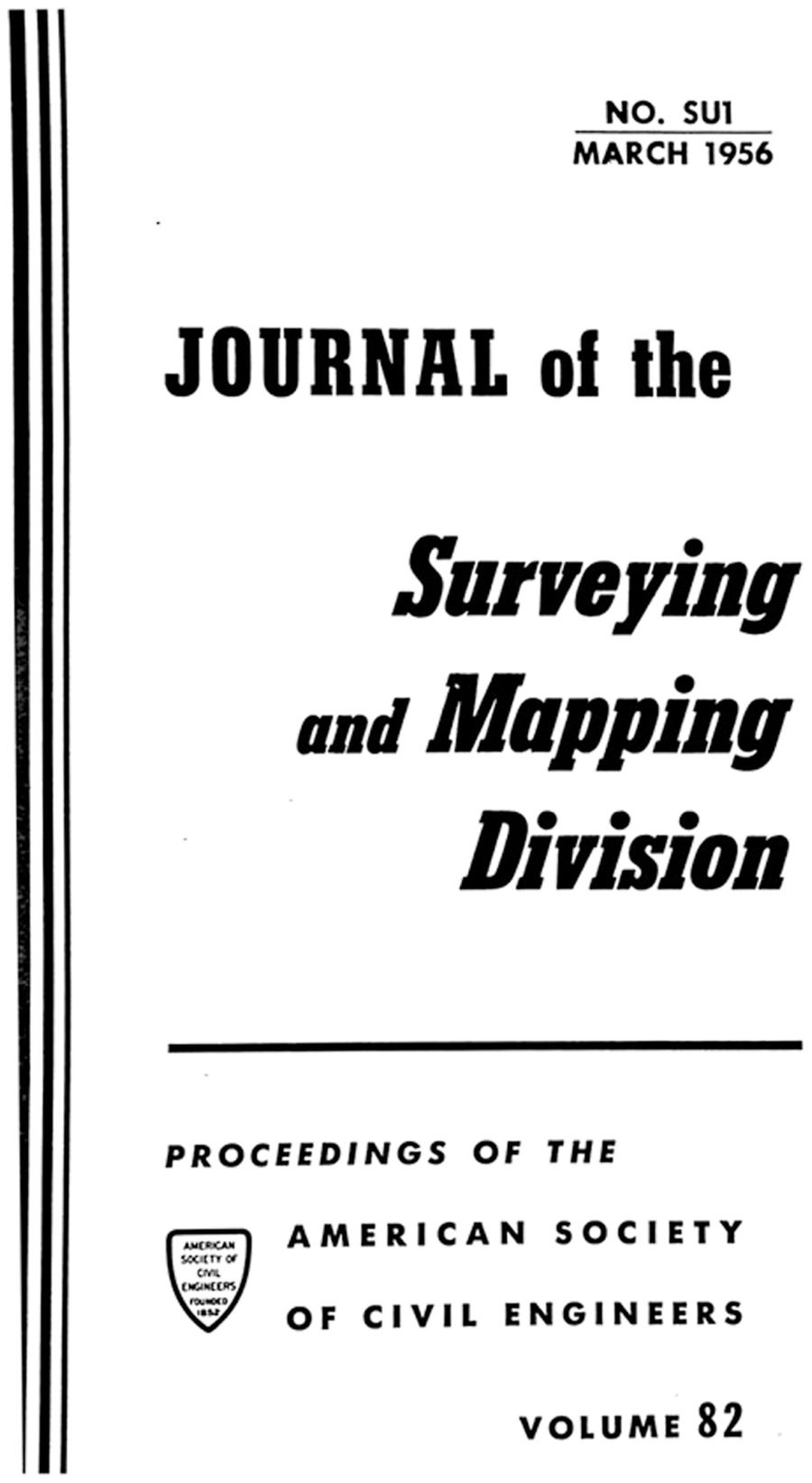
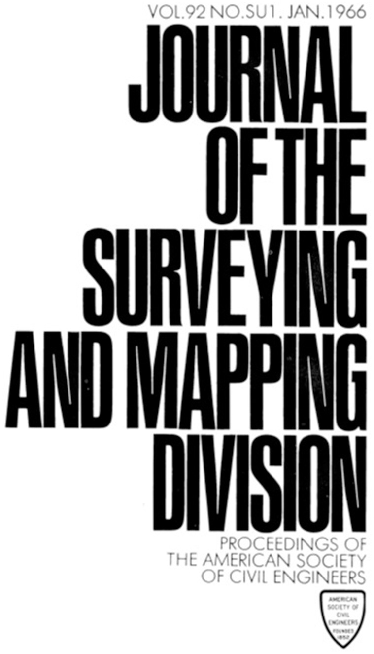
As said by Robert Burtch, the journal was published then at the reduced dimensions of . The front cover shown in Fig. 1 continued to be the norm until it was changed a decade later, in 1966 (Vol. 92, No. 1), adopting a more modern lettering style and enhanced artistic conception (Fig. 2). Incidentally, the frequency of publication of the Journal of the Surveying and Mapping Division changed over the years, comprising a series of random appearances, depending on the specific circumstances of the moment.
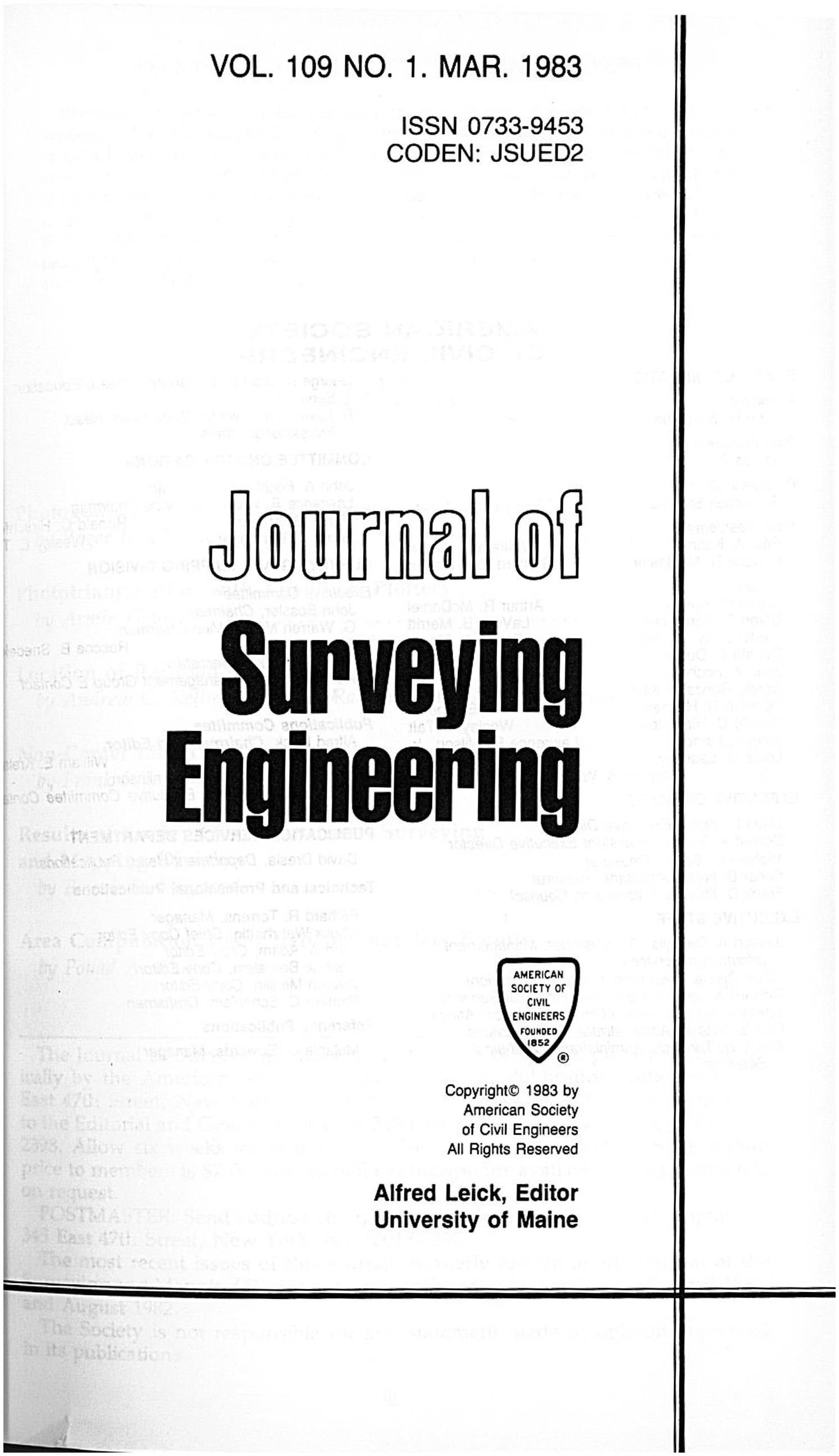
In 1983 (Vol. 109, No. 1), as said by Alfred Leick, the title of the periodical was finally replaced by the one currently in use, Journal of Surveying Engineering (Fig. 3), with the format remaining the same. Notice that the publication was now sponsored by the Surveying Engineering Division due to an organizational change that replaced the original historic name: Surveying and Mapping Division. Furthermore, all references to the Proceedings were removed to ratify the total administrative separation between publications. The frequency of the journal continued to be mostly irregular until 1988, when it was decided to proceed with a quarterly frequency, which remains unaltered to this day.
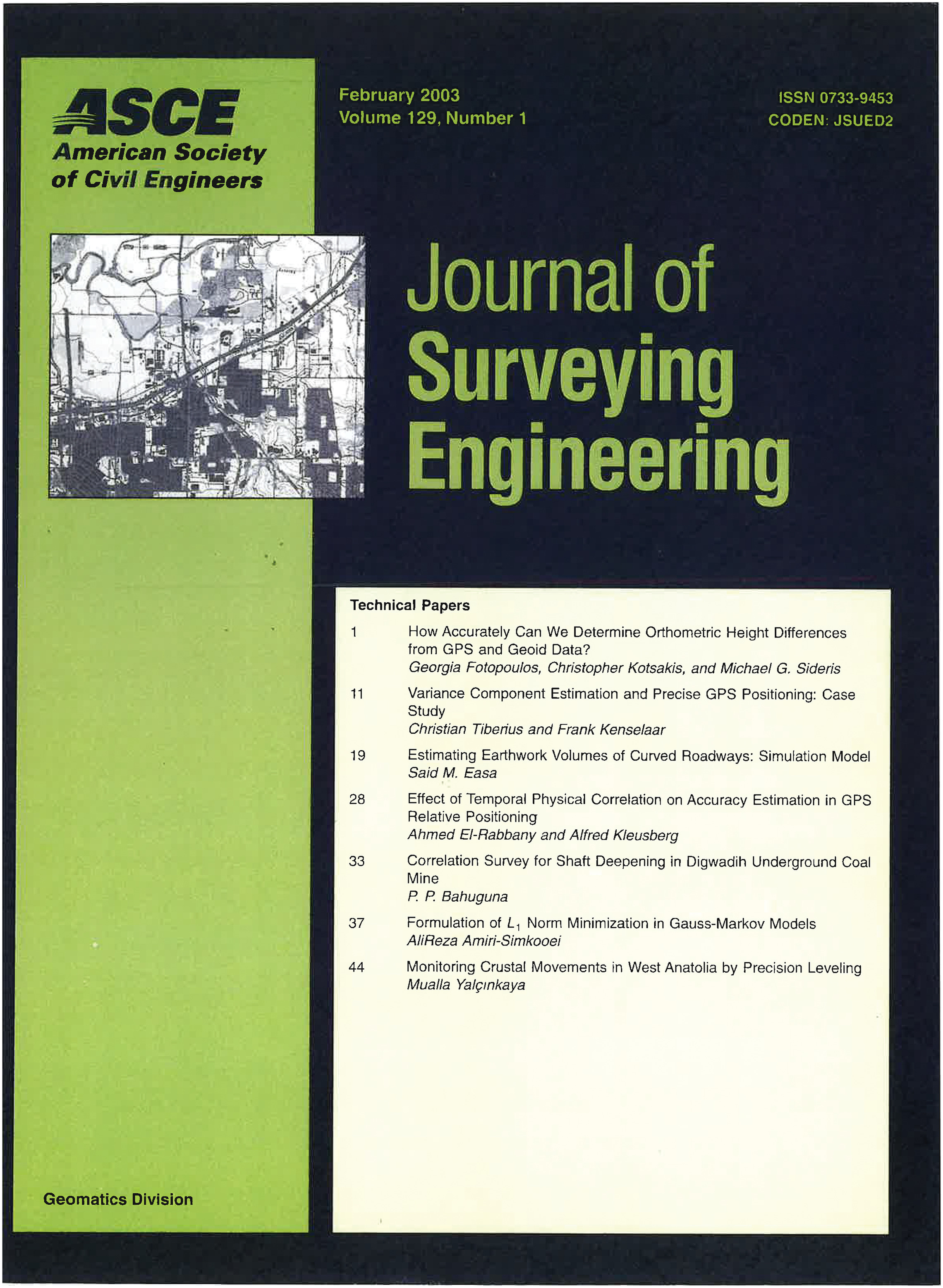
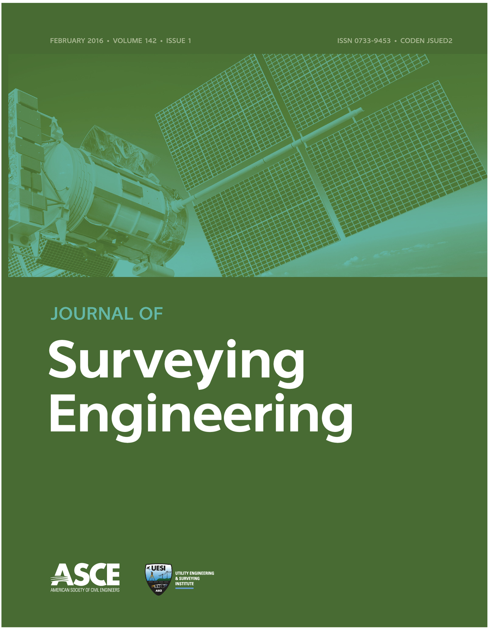
In 2003 (Vol. 129, No. 1) the journal moved to a larger, more scientific format (), increasing the number of contributions that could be accommodated in each issue on account of the availability of more printing space. The front cover was also redesigned (Fig. 4) showing the article titles and their authors as well as the new sponsor, now the Geomatics Division. In 2015, the front cover of the journal was altered one last time; and in 2016 (Vol. 142, No. 1), using the same cover, the current sponsor Utility Engineering and Surveying Institute (UESI), presently responsible for the publication, was added to the page (Fig. 5). This year, 2024, the Journal of Surveying Engineering has reached the pinnacle of publishing its 150th volume, validating the continuous excellence of well-guided team work.
I remember that when I took the helm of the journal, the editorial process was somewhat tedious and cumbersome and, most importantly, very time-consuming, relying mainly on regular mail and fax machines to make things advance. The submissions were received by the ASCE Publications Department, and the manuscripts were accumulated in carton boxes at headquarters until they were distributed piecemeal in posted envelopes to the editors in charge. At the time, practical email communication was in its infancy. However, technology moved faster than anticipated, and by my third year as editor a rudimentary email started to be accessible to most scholarly authors, and the time-consuming process of reviewing prospective articles significantly improved. However, some authors still submitted the manuscript on paper because of the difficulty of printing the mathematical symbols using the software of this pioneering digital network. Routines to correct this problem were swiftly developed by university groups and private companies, and the span of time from submission to review completion was further reduced. In the interim, digital plotting packages were developed, and the figures included in the manuscripts improved considerably, gaining in presentation as well as scientific content. Unexpectedly, overnight, the internet explosion took over the world almost by surprise and publishing was never the same again.
In 2010, a new innovation was implemented in which the journal provided the final draft of every accepted manuscript online in a section of the journal’s website titled “Preview Manuscripts.” This way, interested researchers in the surveying engineering field had access to the latest research months in advance of the final printed publication.
Before I finished my tenure, I was able to use a pilot version of Editorial Manager, a platform currently used by practically all journals internationally to facilitate many management aspects related to the complex peer reviewing workflow. There is no question that this tool has helped manage submissions and the precise archival of correspondence, final decisions, and such, in a central repository accessible to publication departments, editors, authors, and peer reviewers. This is, perhaps, by far, the major transcendental incorporation that has revolutionized electronic publishing.
Summarizing, I think that it was pertinent to mention all the preceding vicissitudes that the journal went through since inception because very little has been written about the different phases that the periodical underwent. Now that we are celebrating this long track record of professional endeavor, it is appropriate to refresh our memory by recalling, concisely, some peripheral aspects in the life cycle of the journal never addressed before in print.
There is no question in my mind that, in years to come, our journal will continue providing plenty of interesting and valued scientific articles describing new breakthroughs in the field of surveying engineering that will reshape our profession along a path of technological development impossible to prognosticate in advance. That is why a thoroughly updated education on themes related to modern surveying, such as multisatellite constellation positioning, 3D laser scanning, synthetic aperture radar (SAR) interferometry, and so forth should be an integral part of the curriculum of civil engineering and an important priority to be seriously considered by scholars and university administrators and where the Journal of Surveying Engineering could be one of the active components to solidify this crucial educational objective.
Michael J. Olsen (Editor, 2015–2023)
I strove to improve visibility and understanding of the importance of fundamental geomatics and geodetic research and innovation to those working in other fields, for example using geomatic technologies in postdisaster reconnaissance, forensic engineering, infrastructure monitoring, and asset management. These efforts are critical to solidify the relevance of our profession, especially when advances have made measurement technology readily available to those with a limited education in geomatics. As technology becomes simpler to operate and end-users expect higher levels of accuracy, fundamental understanding and thoughtful application of geomatics and geodetic principles become increasingly vital. These issues will only compound further with the recent surge in 3D reality capture and AI capabilities; hence, having a strong workforce of surveying engineers will continue to escalate in importance.
During my tenure as editor, the aims and scope of the journal were expanded to include new and innovative applications and technologies within the field of geomatics, such as computer vision–enhanced photogrammetry (e.g., structure from motion, multiview stereo), bathymetric mapping, building information modeling, and civil integrated management. Nevertheless, to ensure that the fundamental purpose of the journal to the field of surveying engineering was not comprised with tangential papers, the scope contained a clear statement that “given the broad reach of these various aspects of geomatics, all submitted manuscripts considered for publication must show a clear advance within and relevance to the field of surveying engineering” (ASCE 2024b). To implement these updates, the editorial board was expanded to include additional experts associated with these new fields of research. Notably, some early career, energetic researchers with a strong publishing and reviewer record were also invited to participate on the editorial board to help ensure the longevity of the journal. Last, a new taxonomy was introduced by ASCE to help streamline the process of finding suitable reviewers for manuscripts.
I also explored the integration of the journal’s activities with other committees within ASCE as well as other organizations. For example, I participated in the effort to expand geomatics within ASCE through the formation of UESI through the integration of the ASCE Geomatics Division and the Pipelines Division. I also assisted with the conceptualization, writing, review, and release of Surveying and Geomatics Engineering: Principles, Technologies, and Applications (Gillins et al. 2022). This manual of practice is a vital resource to provide fundamental understanding of surveying and geomatics for practicing engineers, surveyors, and other geospatial professionals. During my tenure, the journal also published an online special collection containing peer-reviewed papers expanded from the proceedings of 9th International Symposium on Mobile Mapping Technology (MMT) 2015 held at the University of New South Wales (ASCE 2017).
Other notable activities for ASCE UESI during this period included the revitalization of a national conference dedicated to surveying: the Surveying and Geomatics Conference. Two such conferences have been held to date, including one hosted by Cal Poly Pomona in 2018 and another by Cincinnati State University in 2022. Papers have been solicited for the journal through these conferences. Building on this momentum, I worked with others at ASCE UESI to organize a multiorganization partnered conference to be held at Oregon State University in June 2024. In addition to ASCE UESI, the Surveying and Geomatics Educator’s Society (SaGES) and the American Association of Geodetic Surveyors (AAGS) were co-organizers. This conference included a celebration of the 150 years of the Journal of Surveying Engineering. The conference organizing committee is soliciting publications for a special collection in the journal from the conference in collaboration with a parallel effort by the Surveying and Land Information Science (SaLIS) journal. The closing session of the conference explored avenues for these entities to work together moving forward toward addressing the challenges facing geomatics, geodetic, and geospatial professionals, including representatives from other entities who are not directly involved in the organization of the conference. One of my professional ambitions has been to help bring the currently fragmented geomatics community together to elevate the state of practice. Serving as editor of the Journal of Surveying Engineering has been an important step toward that goal. My “Editor’s Farewell” in the previous issue expounds on this vision further (Olsen 2024).
Postscript
In conclusion, this editorial collects the personal reflections of those who have put forth their best efforts to direct the journal in the past decades. This account has been provided in an undoubtedly heterogeneous manner, and it is good that it is so, to respect how each editor sees things and conveys their feelings about the anniversary.
The reader may have different views on the evolution of technological advances over the past 150 years that have shaped the way we do our work and how we communicate it to the scientific community, as well as about the challenges that loom on the horizon. Issues such as the role of artificial intelligence, the way science may evolve in this 21st century, big data usage, and many others are major questions that will be reevaluated, perhaps, in the journal’s 200th anniversary editorial.
References
Agüera-Vega, F., F. Carvajal-Ramírez, and P. Martínez-Carricondo. 2017. “Accuracy of digital surface models and orthophotos derived from unmanned aerial vehicle photogrammetry.” J. Surv. Eng. 143 (2): 04016025. https://doi.org/10.1061/(ASCE)SU.1943-5428.0000206.
Anonymous. 1956. “Preface.” J. Surv. Mapp. Div. 82 (1): 1.
ASCE. 2017. “Special collection on mobile mapping technology (MMT) 2015: Selected papers from 9th International Symposium on Mobile Mapping Technology (MMT), 9–11 December 2015, Sydney, Australia.” Accessed June 24, 2024. https://ascelibrary.org/page/jsued2/mmt_2015.
ASCE. 2024a. “Future world vision: Infrastructure reinvented, redefined, reimagined.” Accessed June 21, 2024. https://futureworldvision.org/.
ASCE. 2024b. “Journal of Surveying Engineering: Aims & scope.” Accessed June 24, 2024. https://ascelibrary.org/page/jsued2/editorialboard.
Baselga, S. 2023. “Inaugural editorial.” J. Surv. Eng. 149 (4): 01623001. https://doi.org/10.1061/JSUED2.SUENG-1475.
Bolkas, D., J. D. Chiampi, J. Fioti, and D. Gaffney. 2022. “First assessment results of surveying engineering labs in immersive and interactive virtual reality.” J. Surv. Eng. 148 (1): 04021028. https://doi.org/10.1061/(ASCE)SU.1943-5428.0000388.
Bowie, W. 1929. “The surveying and mapping activities of the federal government.” Proc. Am. Soc. Civ. Eng. 55 (7): 1899–1901.
Bowie, W. 1930. “Status and progress in the art of surveying and mapping.” Proc. Am. Soc. Civ. Eng. 56 (3): 453–463.
Burkholder, E. F. 1995. “Editorial.” J. Surv. Eng. 121 (3): 107–109. https://doi.org/10.1061/(ASCE)0733-9453(1995)121:3(107).
Burkholder, E. F. 1996. “Editorial.” J. Surv. Eng. 122 (4): 143–144. https://doi.org/10.1061/(ASCE)0733-9453(1996)122:4(143).
Burkholder, E. F. 2008. “Editorial.” J. Surv. Eng. 134 (1): 1–2. https://doi.org/10.1061/(ASCE)0733-9453(2008)134:1(1).
Counselman, C. C., III., R. I. Abbot, S. A. Gourevitch, R. W. King, and A. R. Paradis. 1983. “Centimeter-level relative positioning with GPS.” J. Surv. Eng. 109 (2): 81–89. https://doi.org/10.1061/(ASCE)0733-9453(1983)109:2(81).
Gillins, D. T., M. L. Dennis, and A. Y. Ng. 2022. Surveying and geomatics engineering: Principles, technologies, and applications. Reston, VA: ASCE.
Harrison, A. E. 1963. “Electronic surveying: Electronic distance measurements.” J. Surv. Mapp. Div. 89 (3): 97–116. https://doi.org/10.1061/JSUEAX.0000143.
Kavouras, M. 1995. “Future of surveying engineering—A perspective from Greece.” J. Surv. Eng. 121 (3): 128–135. https://doi.org/10.1061/(ASCE)0733-9453(1995)121:3(128).
National Research Council. 1980. Need for a multipurpose cadastre. Washington, DC: National Academies Press.
National Research Council. 1983. Procedures and standards for a multipurpose cadastre. Washington, DC: National Academies Press.
NCEES (National Council of Examiners for Engineering and Surveying). 1997. Report of the task force on the NCEES model law for surveying. Greenville, SC: NCEES.
Olsen, M. J. 2024. “Editor’s farewell.” J. Surv. Eng. 150 (3): 01624001. https://doi.org/10.1061/JSUED2.SUENG-1540.
Snay, R. A., and T. Soler. 2008. “Continuously operating reference station (CORS): History, applications, and future enhancements.” J. Surv. Eng. 134 (4): 95–104. https://doi.org/10.1061/(ASCE)0733-9453(2008)134:4(95).
Soler, T. 2014. “William Bowie: Eminent scientist and first chairman (1926–1940) of ASCE’s Surveying and Mapping Division.” J. Surv. Eng. 140 (1): 2–11. https://doi.org/10.1061/(ASCE)SU.1943-5428.0000117.
Thompson, M. M. 1977. “Automation in surveying and mapping: Present and future.” J. Surv. Mapp. Div. 103 (1): 15–24. https://doi.org/10.1061/JSUEAX.0000499.
Wolf, P. R. 2002. “Surveying and mapping: History, current status, and future projections.” J. Surv. Eng. 128 (3): 79–107. https://doi.org/10.1061/(ASCE)0733-9453(2002)128:3(79).
Wolf, P. R., B. A. Dewitt, and B. E. Wilkinson. 2014. Elements of photogrammetry with application in GIS. 4th ed. New York: McGraw-Hill.
Wolf, P. R., and C. D. Ghilani. 1997. Adjustment computations: Statistics and least squares in surveying and GIS. 1st ed. Hoboken, NJ: Wiley-Interscience.
Wolf, P. R., and C. D. Ghilani. 2006. Elementary surveying: An introduction to geomatics, 11th ed. Upper Saddle River, NJ: Prentice Hall.
Information & Authors
Information
Published In

Journal of Surveying Engineering
Volume 150 • Issue 4 • November 2024
Copyright
© 2024 American Society of Civil Engineers.
History
Received: May 10, 2024
Accepted: May 10, 2024
Published online: Aug 8, 2024
Published in print: Nov 1, 2024
Discussion open until: Jan 8, 2025
Authors
Metrics & Citations
Metrics
Citations
Download citation
If you have the appropriate software installed, you can download article citation data to the citation manager of your choice. Simply select your manager software from the list below and click Download.